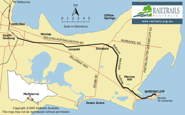
Location - 75 Km from Melbourne
Trail Start - At Strong Street, near South Geelong Railway Station (good car parking available at nearby Geelong Showgrounds)
Trail Length - 34 Km (Geelong to Queenscliff)
Track Surface - Mostly fine compacted gravel - bitumen sections at South Geelong, Leopold, Curlewis and Queenscliff (approx 12 kms in total).
Railway - The Bellarine Peninsula Railway operates between Drysdale & Queenscliff
Gradient Chart
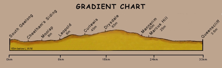
(Chart included with permission of City of Greater Geelong)
This chart indicates the gradients encountered along the trail between South Geelong and Queenscliff. Mostly the trail is fairly flat with only gentle undulations, the railway corridor having been originally planned with minimal grades so as to facilitate haulage of loaded trains by small locomotives. The steepest section of the trail is the Leopold hill, approximately 8 kilometres from South Geelong, which rises from the lowlands of Moolap to a height of about 40 metres above sea level. It then continues along this higher ground rising to a maximum of 60-70 metres before the gradual descent commences. The final section of 4/5 kilometres follows the shoreline of Swan Bay close to sea level to complete the approach into Queenscliff.